A Riverfront View
Development is taking root

-

- The riverfront near IPFW, photography by Christopher Redmond
-

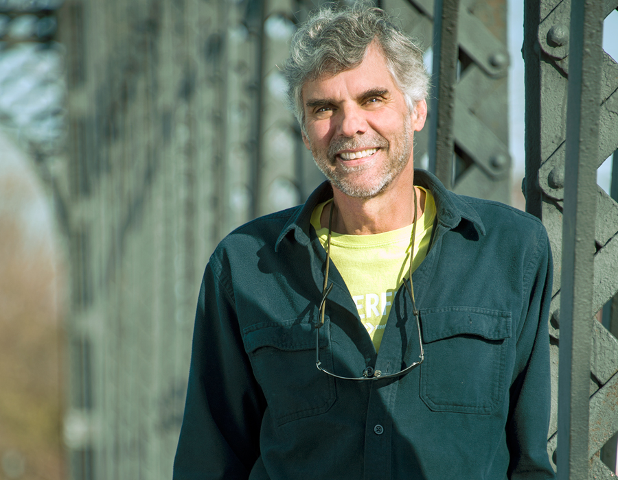
- Dan Wire, photography by Neal Bruns
-

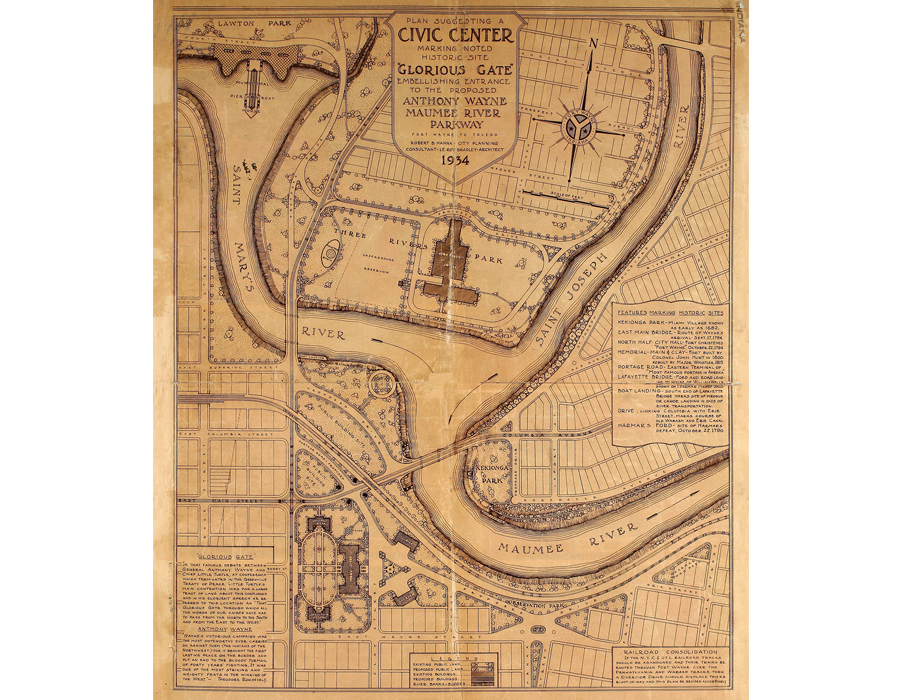
- A version of this map hangs in Citizens Square
-

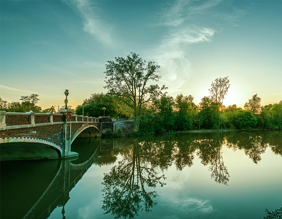
- The Tennessee Avenue bridge, photography by Christopher Redmond
-
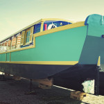
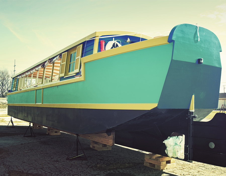
- The canal boat, photography by Tracy Seaman
He planned just a short trip, maybe down around a bend and back.
That’s what Dan Wire had in mind, at least. Finally, after several weeks of asking, Mayor Tom Henry was paying him a visit. Riverfront development was all the rage in local headlines, and Wire thought Henry should see the three rivers which converge at the heart of our city up close and personal.
So one Monday after work about three or four years ago, Henry and his wife, Cindy, met Wire at his boat for some hors d’oeuvres and wine.
“I told him, ‘Mayor, I’m very respectful of your time. How long do you have?'” Wire recalled. “He told me maybe a half hour or 45 minutes.”
But then something happened.
Wire took his boat around one bend and Henry asked what was around the next. Then the next. The mayor kept wanting to know what was around the next corner, what could be seen with the next turn, where you could get to by using just our waterways as transportation.
A short trip around the bend turned into a more than three-hour excursion.
“I’m not saying I changed the mayor’s opinion on anything,” Wire said. “But I think he began to see and think, ‘Oh my gosh! Look what we’ve got!'”
There is probably nobody who knows the St. Marys, Maumee and St. Joseph rivers in the Fort Wayne area better than Wire, who has spent roughly 60 years living along and traversing the waterways on which the city was founded.
He’s been on these rivers when boat and raft races were regular things, and he’s been on these rivers when everyone wondered about water quality and the activities along them long dried up.
There is probably no better advocate for the plans that are drawn up for riverfront development – the space for businesses, the drive to make the rivers more ecologically friendly or the dreams of a riverfront populated by citizens enjoying a night out in their hometown – than Wire.
Wire knew he was up against long-held beliefs that our river water wasn’t of high quality, that the brown of our rivers equaled something bad, that anyone who would go swimming in them was nuts and that all they caused Fort Wayne was the pain of flooding.
He knew he had to do what he did with the mayor: get people out to those rivers.
“If people can see the rivers and use the rivers, they will care about the rivers,” Wire said.
One more time around
Long before the dreams of rooftop terraces and pedestrian bridges as part of a promenade area, and long before the ideas of a pavilion, event lawn, urban bioswale and a dock were designed and mapped out and put on paper as a very real possibility, city leaders saw the value of our rivers all the way back in the early 1900s.
Go to the Main Street Bridge. Find the overlook.
A plaque was dedicated here once to the Fort Wayne Civic Improvement Association. It featured two reclining women – one of which represents “Nature Sleeping”; the other, “Natural Beauty Awakened” – and was put there as “a testimonial of appreciation by citizens of Fort Wayne of the generosity of Theodore F. Theime who erected the work to awakening of a new civic spirit and the beginning of a general scheme of River Improvement.”
Nothing further, however, happened.
At the History Center on Barr Street is a photo from 1921 depicting a man using a giant stick to point up at a picture of the rivers. Wire has used this photo in presentations, an example of how even then city officials had some sort of plan for our rivers.
But again, nothing happened.
There’s also a giant mural inside Citizens Square. Our rivers are big and bold and emblazoned on the giant canvas. Also big and bold are the words “Glorious Gate,” which is what the Native Americans in the area called this spot, as it could essentially connect Montreal to the Wabash Canal and New Orleans.
The mural is adorned with people playing on the waterways, enjoying time on our public beach – yes, we had one, in what is now Johnny Appleseed Park – and everything that could be developed along the banks.
During this time, we built water treatment plants, dams and sewers.
Nothing substantial as far as development happened, though.
“It’s not a new idea,” said Wire of riverfront development. “We’ve just kind of come back again.”
There are differences, though. Huge, dramatic differences, according to Wire. The main one being that seasoned professionals are involved – professionals who are wanting to help make this development happen in a way that hasn’t been done before.
Several years ago, around when Tom Henry showed up to take a “short” cruise along the rivers, Wire also took then-Deputy Mayor Mark Becker and his wife, Cheri, for a ride along the rivers. Wire brought a grill and the couple prepared food right there on the boat.
Mark Becker later became the head of the riverfront development project and has noted the view from the rivers themselves change your entire outlook of the city. In fact, Henry was so impressed with his cruise he had Wire take many staffers from the mayor’s office out on his boat, as well.
Officials with the city’s Parks and Recreation Department have stepped in and helped identify places where wildlife can flourish along the rivers while still allowing for development. Others have identified ways to not exactly preserve the environment along the rivers, but make it better, transforming parts from the mono-ecological environment they are today to an area that can support many plants and animals.
These areas will provide natural habitats for our many species along the banks of the rivers, and give people a chance to get a peak of these animals in action.
“We’re working beside professionals who really know what they’re doing,” Wire said of development efforts. “It’s way more integrated. All of this is a very sound plan.”
Nothing can be done, as always, without money.
Backing riverfront development is $10 million in Legacy funding – which is money invested from the lease and sale of the city’s old electric power utility – already approved for phase one of the project. While there is debate about how to use Legacy money on other development projects, without it these riverfront dreams would likely go unrealized, as they did in 1911, 1921 and 1934.
“I have to throw a lot of credit to the mayoral administration,” Wire said. “That’s made the difference. You have to have great ideas, but you need funding. I need to credit the mayor with having a bold, transformative process, and that’s exactly what this is.”
Get a boat, and the people will come
The philosophy with which Wire lured Henry out to the rivers – how he looks at the places where he grew up and lived for most of his life – changed during a simple conversation with a 24-year-old IPFW graduate student a few years ago.
“She told me: ‘If people could see the rivers, they would think about using the rivers. And when they use the rivers, they’ll care about the rivers,” Wire said. “To me that was so profound.”
For years, Wire has been fighting negative ideas about the rivers.
They are brown, therefore they are dirty. They do nothing but flood. When it rains, it’s time to grab sandbags and head for high ground.
“A lot of people have been thinking the rivers were our enemies,” Wire said.
He quit trying to convince people how great our rivers were. He figured he could use all the facts and data about to change their minds in person, but the minute he left them alone they would have 25 years or so of programming from what they’ve seen in the news or media – our rivers equal floods.
He also began getting people out on the rivers himself.
Wire showed people you could boat down the rivers. You could take a pontoon or kayak, and everything would be fine. He’d show them new ways to see the cityscape and skyline and new ways to get from, say, Quimby Village to the downtown area using nothing but waterways.
He worked with the Three Rivers Festival to get the famous Raft Race back, a popular staple of the 1970s and 1980s which, until recently, had a long hiatus. Wire joined or helped form various groups, such as the Tri-State Watershed Alliance, a nonprofit organization designed to sustain healthy watersheds in the area.
Wire went with city officials and others to various places like Providence, Rhode Island, to see what other communities did with their riverfronts. Most importantly, he got people out on those rivers.
During a weekend in 2014, Wire offered river excursions to the public as the city vied for $42 million in Regional Cities funds. In two days, Wire and several others got nearly 4,000 people out on the rivers, taking trip after trip after trip.
“It was like Disneyland, man,” Wire said.
And yes, flood control will always be an issue with the rivers, but it can be handled. The Environmental Protection Agency has grown claws in recent years, Wire said, and our water is fine. If it wasn’t, Fort Wayne would be facing fines and penalties.
He’s even tested it himself.
Currently, phase one of the project is set to occur on both the north and south banks of the St. Marys River between Harrison Street and the Wells Street Bridge. There are designs for an urban street park, an event pavilion, a central plaza and docks. Construction is scheduled to begin this summer.
Wire is excited, though he knows he’ll never see the full project through to completion.
“A lot of what we get started now, I won’t see,” he says.
But while our dreams are years down the line, he fully expects we’ll get there. The rivers he grew up on, the rivers he’s helped cultivate, will not look the same 20 years from now, and they may change even more during the next century.
Fort Wayne, Wire hopes, will not be like any other place.
And a big part of that will be due to him.
Rise of the Canal Boat
Seeing is believing.
That’s the adage riverfront development advocates are hoping works as they try to get people out to see the rivers – and the city – in a new way. One group, Friends of the Rivers, will offer rides on our three rivers using an 1840s-era replica canal boat this summer.
“We hope this canal boat will attract people from all over the region and that a ride on our canal boat will be a must-do for our residents and visitors alike,” said Irene Walters, president of Friends of the Rivers, at a press conference in March.
The boat is 54 feet long, 11 feet wide and can accommodate 40 people. Dan Wire, who grew up along the rivers and has spent years getting people out on them to show how much potential they have, will be one of the captains.
“I’m going to get people to see the rivers,” Wire said. “I want to show people we have boaters and kayakers out there, so people can see and say, ‘You know, I never thought about that.'”
Cruises will be about 90 minutes long, with the boat going no more than three miles per hour.
The boat is designed to be similar to those which passed through the city on the Wabash and Erie canals in the mid-1800s, and also designed to give city residents a new view of their skyline and the areas they never see from the streets or their cars.
It will also allow them to see where development is designed to take place – where city officials hope to someday have pavilions, docks and walkways as well as businesses and natural places dotting the banks of our rivers.
River facts
Early settlement: Meeting at the heart of the city, the St. Marys, St. Joseph and Maumee rivers have always played a role in the settlement, defense, transportation and commerce of the city. Fort Wayne began to withdraw from its heart throughout the 20th century as residents began moving to the suburbs.
Fish: There are a variety of sport and non-game fish in the rivers. Saugeye – a walleye-sauger hybrid – have been found along with largemouth and smallmouth bass, white
and black crappie, bluegill, catfish, river chub, creek chub, yellow bullhead and longear sunfish. Non-game fish such as carp and suckers account for most of the identified species.
Brown water: As the rivers move, they collect soil and sediment that is washed from farm fields and debris that is washed from developed areas when it rains. When the rains are heavy, the rivers become even more brown because of the soil in this part of the state. The soil is made up of very tiny particles that tend to float easily, so when the sun shines on the river, the soil soaks up the light rays.
Riverflow: Many think our rivers flow from north to south, but in reality they don’t follow that exact path. The St. Joseph River begins in Hillsdale County, Mich., and flows southeast into Ohio, then turns southwest to Fort Wayne. The St. Marys begins near Celina, Ohio, and flows northwest into Fort Wayne where it meets the St. Joseph. Those two form the Maumee River, which flows northeast into Toledo, Ohio, before ending at Lake Erie.
Facts courtesy of Riverfront Fort Wayne. More can be found at www.riverfrontfw.org.
First appeared in the May 2017 issue of Fort Wayne Magazine.